


These tools and metrics are designed to help AI actors develop and use trustworthy AI systems and applications that respect human rights and are fair, transparent, explainable, robust, secure and safe.
FloodMapp - ForeCast, NowCast and PostCast
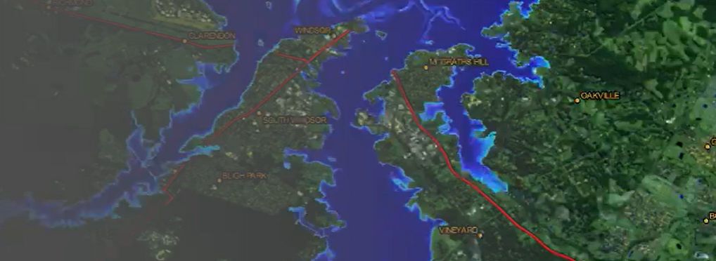
FloodMapp is a technology company focused on providing rapid, real-time flood forecasting and flood inundation mapping. Its aim is to improve early warning systems and situational awareness for emergency services and decision-makers. FloodMapp delivers street-level flood information as a live mapping feed that can be used before, during, and after a flood event. This supports more informed preparedness, response, and recovery efforts.
Key features:
- High-resolution data: data at 1-metre resolution, providing accurate insights to support targeted responses and efficient resource deployment.
- Designed for emergency management: developed specifically to meet the operational needs of emergency services, offering access to critical impact data in real time.
- GIS integration: integrates directly into commonly used GIS platforms such as ESRI, enabling teams to work within their existing systems and workflows.
- Live operational intelligence: real-time updates give emergency managers access to current information, supporting timely and informed decision-making during flood events.
It offers three main services: ForeCast, NowCast and PostCast.
ForeCast provides near-term flood extent and depth forecasts, delivered as a live data feed directly to a GIS environment. The feed is continuously updated as flood conditions evolve. This information can assist with pre-event planning and mitigation, helping teams to allocate resources more effectively and reduce potential impacts. It includes not only:
- Identifying and preparing high-risk areas;
- Pre-positioning personnel and equipment;
- Planning evacuation routes and safe access points;
- Sharing a common operating picture across organisations;
- Issuing alerts to communities likely to be affected;
- Preparing for disruptions to essential services.
NowCast provides live flood impact data, enabling teams to monitor events as they develop and respond accordingly. It contributes to a shared situational picture across agencies. This includes real-time intelligence on affected populations, infrastructure, and properties, which can guide response strategies. It includes not only:
- Monitor evolving impacts and inform response;
- Close affected roads and redirect traffic;
- Coordinate evacuations based on current data;
- Share information across organisations;
- Prioritise critical infrastructure and vulnerable groups;
- Issue localised alerts to communities at risk;
- Support decision-making at both state and local levels
PostCast provides flood extent and depth data after an event, helping to identify affected areas without the need for time-consuming field surveys. This supports faster assessment and recovery. The system offers property-level detail, which helps determine where assistance is most urgently needed and streamlines resource deployment. It includes:
- Mapping maximum flood extent and depth;
- Identifying affected people, property, and infrastructure;
- Planning recovery and rebuilding;
- Supporting community resettlement;
- Directing clean-up operations efficiently;
- Communicating impact assessments to stakeholders and others.
FloodMapp’s suite of tools supports emergency management across the entire flood lifecycle—before, during, and after an event—providing timely, location-specific data to improve decision-making and response outcomes.
About the tool
You can click on the links to see the associated tools
Tool type(s):
Objective(s):
Purpose(s):
Target sector(s):
Country/Territory of origin:
Maturity:
Usage rights:
Target groups:
Geographical scope:
Tags:
- image recognition
- data
- geospatial information systems
- forecasting
- natural disasters
Use Cases
Would you like to submit a use case for this tool?
If you have used this tool, we would love to know more about your experience.
Add use case


 Partnership on AI