

























Name in original language
Bruk av KI for analyse av aktivitet på gategrunn
Initiative overview
Bergen is experiencing increasing pressure on curbside and shared urban spaces. Growth in micromobility, urban deliveries, flexible loading needs, pedestrian prioritisation, and dynamic public space regulations requires more adaptive and data-driven management tools. Traditional curbside regulation—based on static signage and manual enforcement—does not provide sufficient insight into how space is actually used, where conflicts arise, or how capacity should be adjusted over time.
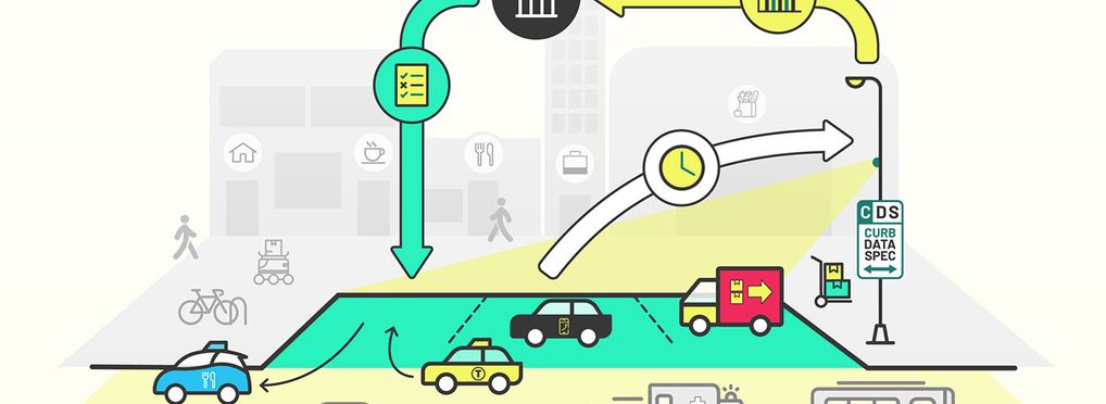
To address this, we are developing an AI-enabled curbside analytics tool that combines CDS/MDS-based regulation software with privacy-preserving video analytics in public streets. The foundation of the system is a digital Curb Data Specification (CDS) framework, aligned with standards developed by the Open Mobility Foundation. This enables us to digitally define and manage geofenced curb zones—such as loading areas, micromobility parking, short-term stopping zones, pedestrian-priority areas, or flexible shared-use spaces—and adjust regulations dynamically. On top of this regulatory layer, we plan to integrate AI services that process blurred video streams from public-space cameras. The system will not identify individuals; instead, it will classify movement patterns and user categories such as delivery vans, private cars, buses, pedestrians, cyclists, and micromobility devices. CDS-defined geofenced areas will be mapped directly into the video image, enabling the AI to monitor how specific zones are used in near real time.
By combining regulation data with observed behaviour, the system will allow us to measure intensity of use, dwell times, availability rates, peak load periods, modal distribution, and potential conflicts between user groups. It will also support identification of capacity bottlenecks, safety risks, congestion dynamics, and patterns of non-compliance. We are currently planning a pilot analysis near the city square. A key focus will be loading zones that shift function during the day, assessing how real-world behaviour aligns with intended regulations.
The objective is to generate improved insight into curb turnover rates, better understanding of micromobility parking patterns, and more precise identification of conflicts between delivery traffic, cyclists, and pedestrians. The broader ambition is to establish a scalable methodology for AI-supported curbside planning. By combining geofencing, standardised digital regulation, and privacy-conscious video analytics, Bergen aims to move towards more adaptive, evidence-based management of shared urban space—supporting safer streets, more efficient logistics, and better allocation of limited curb capacity.