





















Name in original language
Catania Gemello Digitale Intelligenza Artificiale
Initiative overview
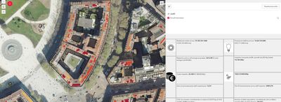
The initiative develops an AI-powered digital twin of the City of Catania, a metropolitan area of approximately 1.2 million inhabitants. Catania is characterised by the presence of a major commercial port, an international airport, and its proximity to Mount Etna, one of the most active volcanoes in Europe. The city also experiences significant daily mobility flows, with around 800,000 vehicles entering from the surrounding Etna municipalities. These factors create complex challenges in terms of mobility management, environmental monitoring, infrastructure resilience, and emergency preparedness.
The digital twin integrates data from transport systems, environmental sensors, public services, and urban infrastructure into a unified virtual model. It enables public authorities to simulate scenarios related to traffic congestion, volcanic risk, port and airport operations, climate events, and infrastructure maintenance. By providing predictive analysis and real-time monitoring, the system supports more informed and co-ordinated decision-making.
The main objective is to strengthen urban planning, optimise resource allocation, and enhance risk management in a city exposed to natural hazards and high mobility pressure. By testing policy options in a virtual environment before real-world implementation, the initiative reduces costs, limits unintended consequences, and increases transparency for citizens and stakeholders.
In the future, the initiative is expected to expand through the integration of additional data sources and AI capabilities, becoming a permanent decision-support system within public administration. It may be scaled at regional level and connected with other territorial platforms, fostering collaboration between public institutions, research centres, port and airport authorities, and private operators. Over time, the digital twin will contribute to making Catania more resilient, sustainable, and efficient.
Results, outcomes and impacts
The initiative has improved data integration and co-ordination across municipal departments, reducing analysis time for urban planning scenarios by an estimated 30%. Pilot simulations on traffic flows and emergency response have supported more efficient decision-making and risk assessment. Results have been measured through performance indicators such as response time, data processing speed, and scenario comparison accuracy. In the future, the initiative is expected to reduce congestion, improve infrastructure maintenance planning, and enhance resilience to volcanic and climate-related risks.